Cross slopes play a big role in how safe and durable our roads and sidewalks are. They guide water away, reduce hazards, and help pavement last longer, all while keeping traffic moving smoothly.
What Is a Cross Slope?
A cross slope is the slight tilt built into roads and sidewalks to keep water from pooling. Usually around 2%, this angle directs water off the surface, reducing hydroplaning risks and preventing pavement damage.
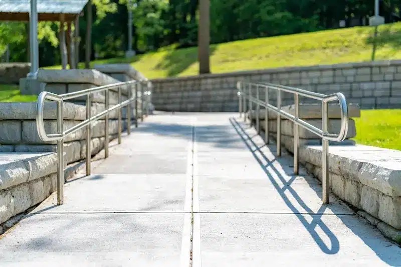
Properly designed cross slopes meet ADA (Americans with Disabilities Act) standards. This makes sidewalks and ramps easier for people with disabilities to navigate.
Why Cross Slopes Matter
Water is pavement’s biggest enemy. Without proper drainage, it can seep in, weaken the structure, and shorten its life. Cross slopes help solve this by guiding water to drains or gutters.
Beyond drainage, cross slopes also contribute to:
- Safety: Preventing water accumulation reduces the risk of skidding and hydroplaning for vehicles
- Accessibility: Well-designed cross slopes meet ADA (Americans with Disabilities Act) standards. This makes sidewalks and ramps easier for people with disabilities to navigate
- Durability: Cross slopes reduce water infiltration, which helps pavements last longer
Where Are Cross Slopes Used?
Cross slopes are used in a variety of contexts, each with specific design considerations:
- Roadways: In road design, engineers apply cross slopes to the travel lanes and shoulders
- Sidewalks: Sidewalks need careful cross slope design to ensure both drainage and accessibility
- Parking Lots: In parking areas, cross slopes direct water toward collection points without creating discomfort for pedestrians or vehicles
- Ramps and Driveways: Ramps, especially those used for accessibility, must balance slope requirements for drainage with strict ADA guidelines
Get the full breakdown of design strategies, common mistakes, and the latest innovations. Click here to read the complete article on the GPRS website.
What to Consider When Designing Cross Slopes
Designing a cross slope requires a balance of engineering principles and practical considerations. Several factors shape the ideal slope:
Surface Material
Different paving materials have distinct reactions to water and wear. Asphalt is more flexible, so it can handle slight changes in slope. In contrast, concrete needs precise grading.
Climate and Rainfall
Regions with heavy rainfall demand steeper cross slopes to ensure rapid drainage. Arid areas may prioritize comfort and accessibility over aggressive water management.
Traffic Type and Volume
High-speed roads use steeper slopes to lower the risk of hydroplaning. Low-speed urban streets have gentler gradients to improve pedestrian safety.
Regulatory Standards
Designers must follow local and national standards. These include guidelines from the Federal Highway Administration (FHWA) and the ADA. They outline acceptable slope ranges for various uses.
Common Challenges and Mistakes
Despite its apparent simplicity, cross slope design can be fraught with challenges. Some common issues include:
- Inadequate Slope
- Excessive Slope
- Uneven Transitions
- Settlement and Deformation
Innovations in Cross Slope Design
New technology is making cross slope design smarter and more precise:
- 3D Modeling & BIM: Visualize slope gradients digitally before construction
- Automated Grading: GPS-guided equipment ensures accurate slopes during paving
- Smart Sensors: Embedded sensors monitor slope integrity and alert teams to changes
Cross Slopes and Sustainability
Today’s infrastructure combines functionality with sustainability. Cross slopes help by directing water toward permeable surfaces, bioswales, or rain gardens, reducing runoff and supporting groundwater recharge. When paired with low-impact development strategies, they make cities more resilient and environmentally friendly.
SiteMap® transforms complex data into interactive insights. The reality capture feature helps your team visualize every detail, stay aligned, and keep projects moving forward.
With SiteMap, you can:
- Access high-resolution 3D models anytime
- Overlay historical and current scans for comparison
- Integrate seamlessly with CAD and BIM tools
Whether you’re planning renovations, verifying ADA compliance, or tracking structural changes, SiteMap keeps your records organized and accessible so your team can collaborate with confidence.
Click below to schedule your free, personal SiteMap demo today!