How SiteMap® Organized Sewer Inspection Data for Analysis and Compliance
SiteMap® was used to deliver the results of GPRS’ video pipe inspection and mapping services for an energy company in New York. This allowed the Department of Environmental Conservation (DEC) to properly analyze the underground pipes.
National Grid contracted Land Remediation Inc., a New York–based civil construction and environmental services company, to perform the site’s required biennial underground sewer pipe inspection.
National Grid’s adherence to DEC inspection requirements highlights its focus on protecting both workers and the surrounding community. These inspections, conducted every other year, check the condition of individual pipe segments and help ensure that maintenance-related byproducts do not impact groundwater infrastructure.
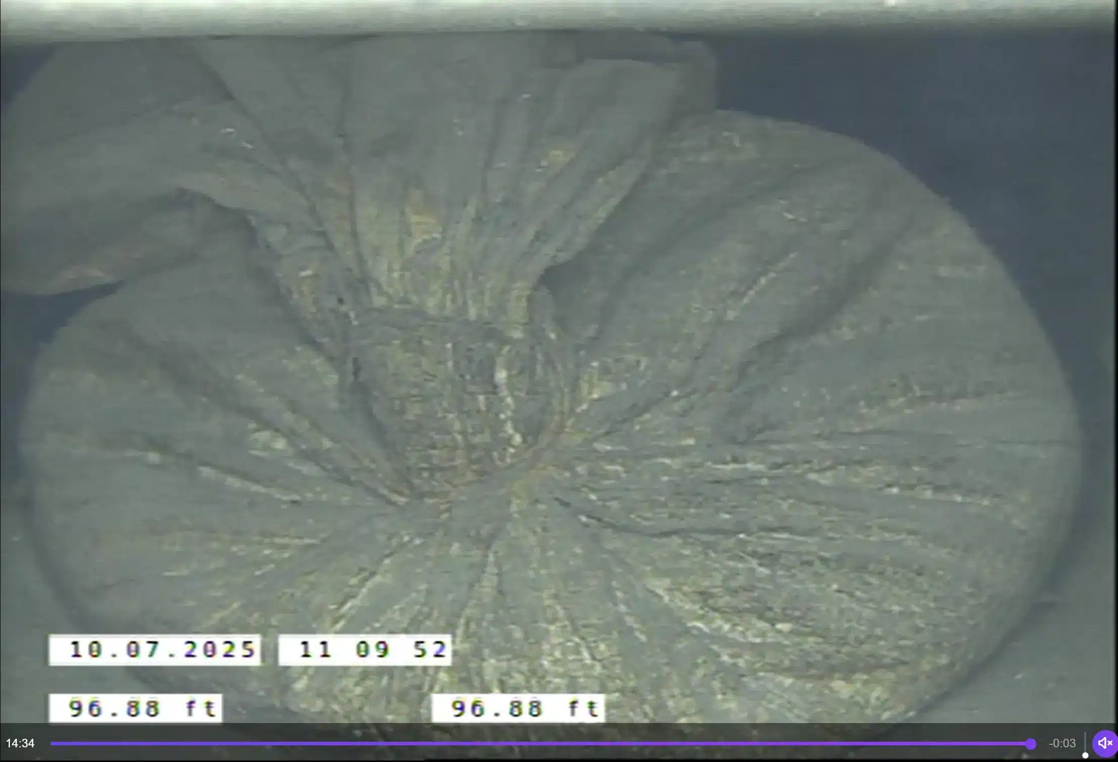
GPRS Project Manager Christopher Frias examined the site’s ground and stormwater systems. He used a remote-controlled CCTV mainline crawler and a push camera for the job.

GPRS Project Manager Christopher Frias leveraged advanced subsurface investigation technology, NASSCO guidelines, and SiteMap to deliver accurate, actionable sewer condition data ahead of schedule.
Land Remediation Inc. had previously worked with another provider. Yet, that provider’s technology and workflows could not meet the specific needs of the project.
“They were able to get more information with the technology that we use, because the cameras are more sophisticated and we have the zoom feature,” Frias explained. “So, if there was an inspection and the rover can’t continue forward, whether it was groundwater or stormwater, our zoom feature can at least give the client an idea of what’s ahead in the pipe.”
In addition to viewing past obstructions, the video zoom capability provides clients with a closer look at pipe conditions, helping to identify potential defects.
During the inspection, Frias encountered many blockages, including a shocking discovery.
Because of the sandbag blocking the flow of water, three pipes connected into the customer’s catch basin were full of water as well.
“I had noticed a lot of sediment had built up within the pipes. A couple of days before I arrived there, they had a big rainstorm,” Frias explained. “The amount of sediment in the pipes is kind of a normal thing on sites like these, but because of that rainstorm, a lot of that sediment had gotten pushed in and there were certain blockages – more so in their storm system. In their ground water system, there was only so much that I could scope because a lot of it was packed with sediment.”
“The most shocking thing that I was able to find was closer to the catch basin that was next to the subsystem that they used. We found a sandbag. It was like those 20- or 30-pound bags that you buy at Home Depot or Lowe’s,” Frias continued. “It was lodged in the stormwater pipe, and it basically had backed up the system for the stormwater.”
Although some of the pipes were partially filled with water, Frias was still able to inspect and document their condition using his advanced equipment.
“That’s also one of the benefits of the types of rovers that we use, they can do inspections even if they’re somewhat submerged in water,” Frias explained.
After completing the investigation, Frias uploaded his findings to SiteMap.
SiteMap provides a secure, centralized platform for storing and accessing underground infrastructure plans.
In 2025, SiteMap expanded its capabilities with the launch of the Sewer Layer.
The SiteMap Sewer Layer brings together NASSCO-compliant WinCan reports and inspection videos. This can make analysis easier and boost teamwork across different asset groups. All data is geolocated, allowing sewer lines, identified through GPRS’ 99.8% accurate underground utility scans, to populate directly on the site’s satellite map in their accurate positions.
When Frias shared the SiteMap Sewer Layer with the customer, they were happy to have their data securely accessible on the platform.
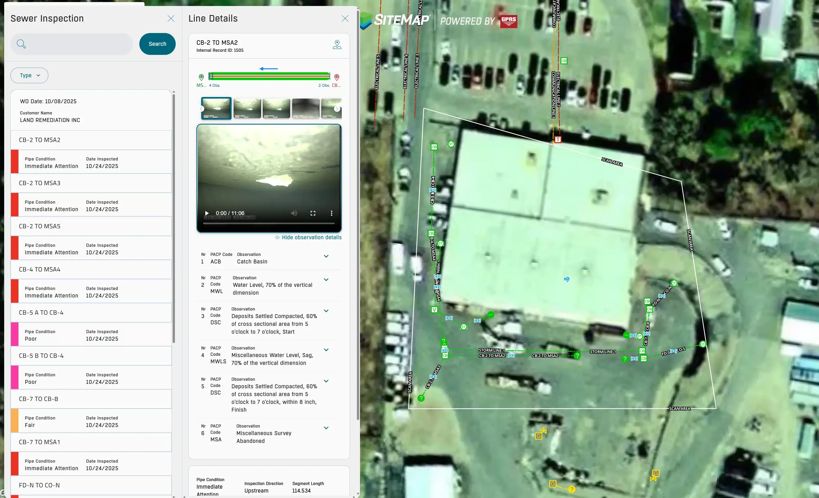
The SiteMap Sewer Layer also includes observation details and a color code to show the conditions of the pipes and what is noteworthy about them.
“I had mentioned to them that yet that we provide the video inspection aspect. We do the NASSCO reporting and then we can also create a map for that. And once I said that, they were like, ‘what do you mean?’
I explained that there are certain enhancements that we now have, so that if I name an access point, the SiteMap team can take the video file that I recorded, attach it to the line, and then the customer instead of having to go through 36 videos, can click that one line segment to physically see the inspection that was done from access point line segment to the next access point. They were impressed not only because our mapping system matched theirs, but also, when I was doing the locating aspect, they were under the impression that one line segment from a catch basin to another catch basin ran in a certain direction. With our locating equipment I was able to determine it was not what they thought. So, they were happy to see that.”
Frias highlighted the value SiteMap delivered for this customer. “With all the abilities that we have with SiteMap, we can name access points, whether it’s a lift station, round catch basin, or square catch basin. It’s always good to have as much information as you can and that that’s something that we can provide the client and they were very happy with that.”
When infrastructure plans are scattered, decision‑making slows down. SiteMap eliminates this challenge by serving as the ultimate deliverable. From vertical assets to underground systems, it brings your data into a single platform to keep teams informed, aligned, and prepared.
Click below to schedule your personal SiteMap demo!