When accuracy is paramount, 3D laser scanning becomes more than just a tool; it’s a key competitive advantage. For architects, engineers, contractors, and facility managers, this technology provides more than accurate measurements. It makes one clear digital record of your project.
What do industry leaders consider when deciding whether to adopt this technology? How can it help reduce risk, improve collaboration, and future-proof your assets? Let’s look at the essentials.
For a more in-depth exploration, read the complete article here.
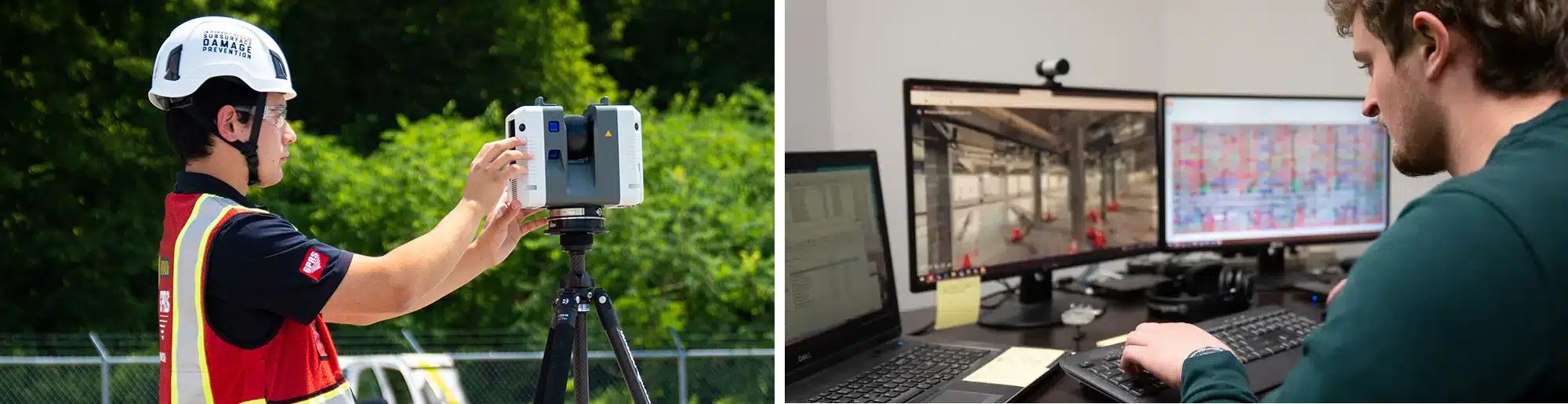
3D laser scanning captures detailed information about your building. This includes dimensions and locations for architectural, structural, utility, and MEP systems, as well as material specs.
From Physical Space to Digital Intelligence
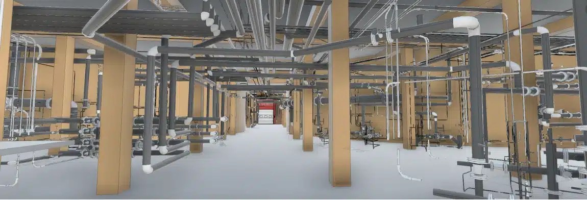
3D laser scanning captures millions of data points to create point clouds. Which can then be converted into CAD drawings or BIM models. These interactive datasets enable teams to explore every angle of a structure without stepping on-site.
When integrated with software like Revit, AutoCAD, or Navisworks, these models become actionable intelligence. This interoperability is what turns raw data into solutions that can reduce rework, speed up timelines, and improve collaboration across teams.
See how this works in real-world projects; check out the full article here.
Why Digital As-Builts Are Essential
Every scan creates a permanent digital record of your site’s conditions. You can use these records for future renovations, compliance audits, and lifecycle management.
For facility managers, this means no more outdated drawings or guesswork. You have a trusted source of truth. Digital as-builts support GIS integration and emergency planning.
Learn how SiteMap® can simplify digital as-built management.
Key Considerations Before You Scan
- Define Your Objectives
Are you capturing as-built conditions for adaptive reuse? Verifying construction progress? Or building a digital twin for long-term asset management? Each goal demands a different level of detail and workflow.
- Understand Your Scope
Square footage, number of floors, and occupancy all impact the scanning strategy.
- Choose the Right Technology
– Large projects need long-range scanners.
– Dense MEP systems may need high-resolution portable units. - Align Stakeholders and Software.
Who will use the data? Architects, engineers, contractors, and facility managers often have different expectations and preferred platforms.
For a full breakdown of these considerations, click here.
The Role of Interactive Data in Modern Workflows
Static drawings are out; interactive models are in. Today’s project teams want to explore 3D spaces. They also need to mark issues and share insights instantly. This level of engagement changes decision-making. It can cut down on miscommunication and speeds up approvals.
Explore interactive utility mapping solutions with SiteMap®.
Accurate as-built documentation can help facility managers plan upgrades and retrofits. This way, you can avoid intrusive surveys during renovations.
Software Integration: The Backbone of Efficiency
Data without context is just noise. That’s why integration with industry-standard software is key. Whether you’re feeding point clouds into Revit for BIM modeling or exporting to Navisworks for clash detection, compatibility can help ensure your scanning investment pays off.
Advanced platforms like SiteMap® even allow for automated updates, so your models evolve alongside your project.
SiteMap®: Your Hub for Reality Capture and Digital Twins
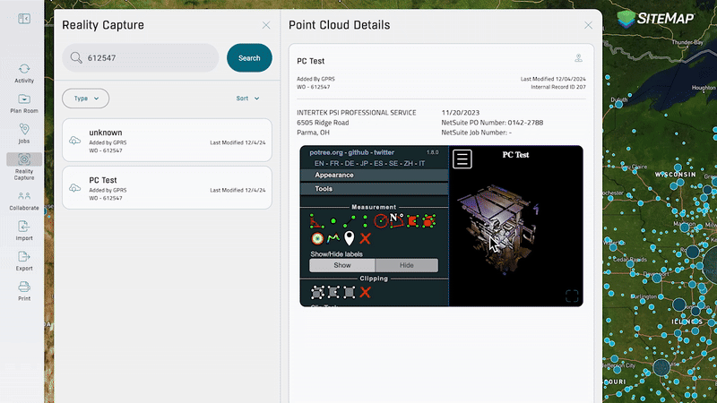
Our updated reality capture features allow you to access and organize virtual tours and point clouds, all in one place. You can filter by file type, search by job details, and interact with your data for a more streamlined experience.
Once your BIM models or digital twins are ready, SiteMap becomes your central hub for managing and leveraging that data. SiteMap transforms complex information into interactive insights, helping keep your team connected and your projects on track.
With SiteMap’s reality capture feature, you can:
- Access high-resolution 3D models anytime
- Overlay historical and current scans for comparison
- Integrate seamlessly with CAD and BIM tools
Whether you’re planning renovations, verifying ADA compliance, or tracking structural changes, SiteMap keeps your records organized and accessible, so your team can collaborate with confidence.
Click below to schedule your free, personal SiteMap demo today!
Make Data Work for You
3D laser scanning helps build a base for smarter, quicker, and safer choices. By focusing on objectives, aligning stakeholders, and choosing the right technology, you can turn raw data into actionable insights that drive project success.
Get the complete breakdown in the full GPRS article here.