Augmented Reality in the AEC Industry: How SiteMap Puts Infrastructure Data Where You Need It
What Augmented Reality Means in Construction
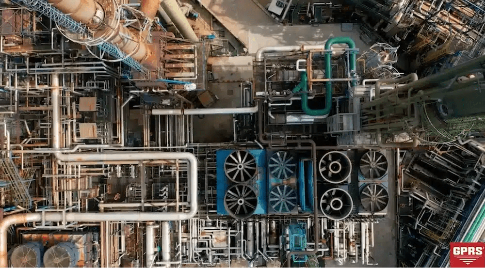
Most construction data lives in the wrong place. Utility maps stay in the trailer. BIM models sit on project managers’ laptops. As-built drawings wait in binders while crews make decisions in the field with incomplete information. The result is predictable: utility strikes, rework, coordination failures, and cost overruns that compound across a project’s lifecycle.
Augmented reality addresses this directly. AR technology uses mobile devices and tablets to overlay georeferenced digital data onto a live view of the physical environment. Field crews see their actual jobsite and the infrastructure beneath it simultaneously; through devices they already carry.
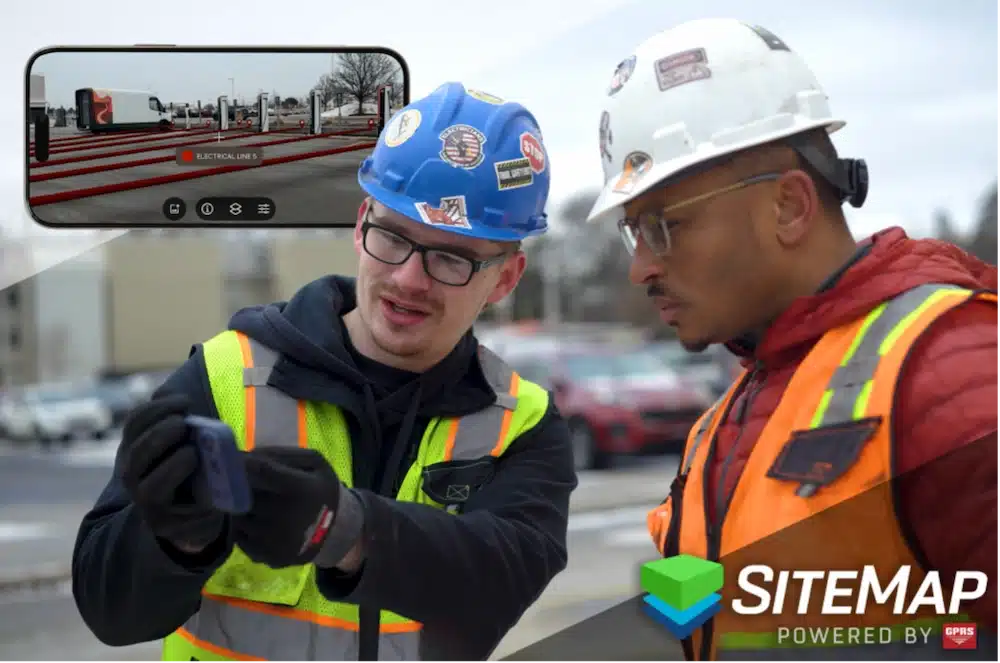
Augmented Reality in Sitemap makes utilities easy to spot in real time with an application accessed directly from your smartphone or tablet.
In the Architecture, Engineering, and Construction industry, that means placing utility maps, building information models, GIS layers, and 3D point clouds into the field at the location and scale where they apply. The difference between reviewing a utility map on a desktop and seeing it overlaid on your actual excavation zone is not a minor convenience. It is the difference between mentally translating a 2D document into 3D space and simply seeing the answer.
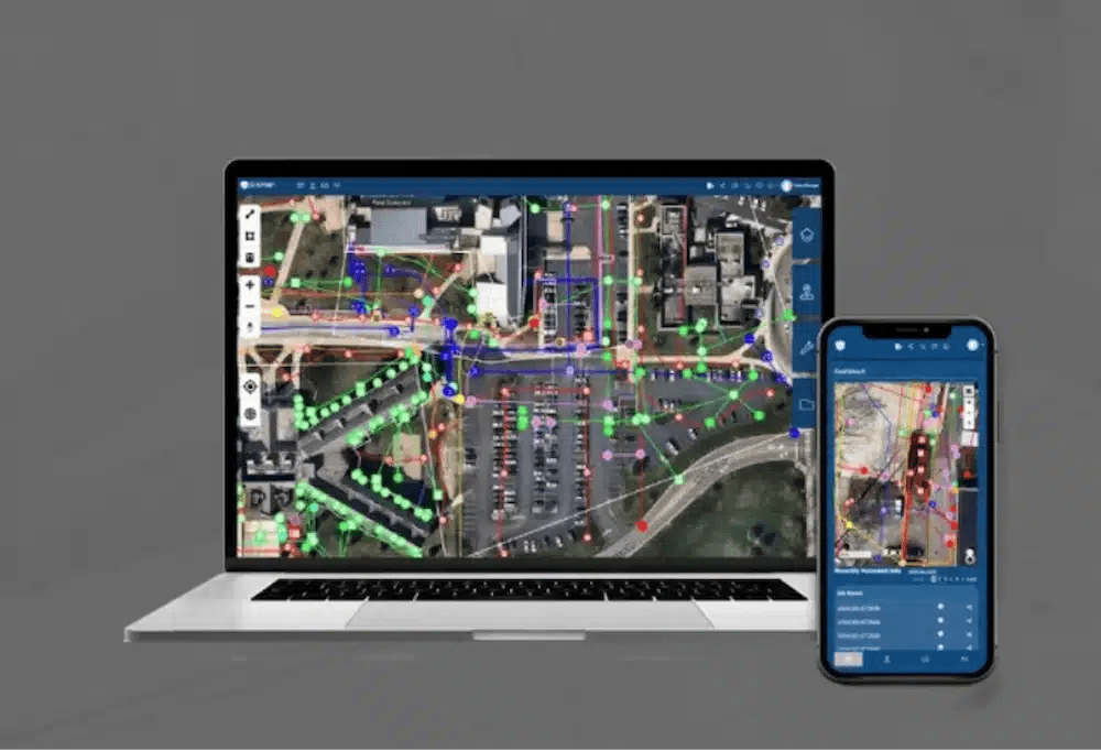
SiteMap® by GPRS is built around this principle. The SiteMap Mobile application uses RTK positioning and GIS mapping to overlay color-coded utility lines, flow direction data, and geolocated infrastructure directly onto the physical environment as users move through it. The platform brings together utility maps, BIM models, CAD drawings, reality capture data, and NASSCO-certified video pipe inspection reports into a single AR-accessible environment, available 24 hours a day from any smartphone or tablet.
Why AR Matters: The Cost of Working Without It
Subsurface infrastructure is invisible until something goes wrong. According to 811 Before You Dig, utility strikes cost U.S. contractors $30 billion annually. Beyond the financial damage, strikes on energized lines, pressurized gas mains, or active fiber routes carry consequences ranging from project shutdowns and regulatory penalties to serious injury and fatalities. Inaccurate or inaccessible subsurface data is a primary cause.
Coordination failures compound those risks across the life of a project. Research from FMI Corporation estimates that rework accounts for roughly 30% of all work conducted on U.S. construction projects, much of it tracing back to conflicts between installed systems and planned work that were never resolved in the model before reaching the field. Rework is expensive under any circumstances. When it involves removing and relocating installed MEP systems or repairing damage caused by an undetected utility conflict, the cost is substantially worse.
AR reduces the rate of line strikes by allowing AEC teams to be able to identify hidden elements on a construction site in real time before they break ground.
Infrastructure projects also have a documented tendency to exceed their cost and schedule budgets by more than project leaders anticipate. In How Big Things Get Done, researcher Bent Flyvbjerg demonstrates that overruns on major projects consistently exceed the buffers most teams build in, meaning the standard approach to contingency planning is systematically underprotective. AR tools that catch coordination failures before work is installed and prevent utility strikes before they occur are not productivity enhancements. They are risk controls.
SiteMap positions its AR features directly within this context. Field crews using SiteMap Mobile can walk a jobsite and see the subsurface utility data GPRS has collected through ground penetrating radar, electromagnetic locating, and GIS mapping overlaid on the physical environment in real time. That data does not need to be mentally translated. It appears at scale, at location, in the space where work will occur.
The Technology Behind SiteMap AR
AR in construction is only as reliable as the technologies supporting it. SiteMap integrates several critical components to maintain accurate, usable visualizations under active field conditions.
Real-Time Kinematic Positioning
SiteMap Mobile uses RTK positioning to maintain centimeter-level geographic alignment between utility overlays and their actual subsurface locations. RTK compares signals from a roving field receiver against a fixed base station, correcting for error in real time. This level of precision is foundational to the platform’s value: an AR overlay that drifts from its true location is not just inaccurate, it is actively misleading at the moment of highest consequence.
GIS and Geospatial Anchoring
SiteMap is built on a GIS architecture. Utility maps, as-builts, BIM models, and reality capture data are georeferenced to actual coordinates and layered within a single spatial environment. When users access that data through the AR interface, every element appears in its correct position relative to the physical world. GIS also enables the platform to serve large, complex datasets to mobile devices in the field without requiring specialized hardware or high-bandwidth connections.
BIM Integration
Building information models provide the structural, mechanical, electrical, plumbing, and civil geometry that AR systems display at full scale within the physical environment. SiteMap integrates BIM models alongside utility maps and point clouds, allowing project teams to compare planned installations against actual site conditions, identify clashes before they are built into the structure, and verify installation progress against design documents from any mobile device.
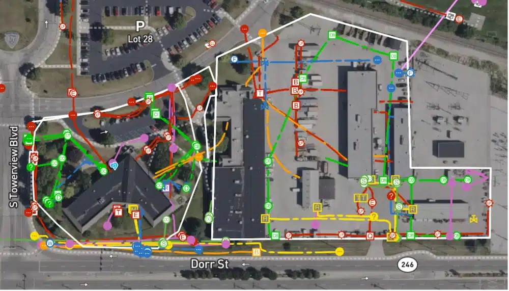
SiteMap centralizes utility maps, CAD/BIM files, NASSCO reports, and reality capture data, providing a single source of truth for safe and accurate project planning.
SLAM and Indoor Navigation
Simultaneous Localization and Mapping algorithms allow AR devices to build and continuously update a map of their environment while tracking their own position within it. In GPS-limited environments such as building interiors, parking structures, and underground spaces, SLAM maintains accurate alignment between digital overlays and physical conditions as users move. This makes SiteMap’s AR functionality usable in the enclosed environments where subsurface conflicts are often most consequential.
Reality Capture and Point Clouds
GPRS 3D laser scanning services produce survey-grade point clouds that feed directly into SiteMap. When integrated with the AR platform, point cloud data allows users to compare design intent against actual installed conditions in real time. As-built verification, BIM coordination, and clash detection all become accessible at the point of work rather than requiring a return to the office or a separate review session.
How SiteMap Applies AR Across the AEC Industry
Subsurface Utility Visualization
Subsurface utility visualization is the application that defines SiteMap’s AR capability. The SiteMap Mobile AR feature allows crews to walk any jobsite or facility and see color-coded utility lines, flow direction data, and depth information overlaid onto the physical environment, anchored to real-world geographic coordinates through RTK positioning. Commonly visualized utilities include water mains, electrical conduits, fiber optic lines, sewer systems, natural gas pipelines, stormwater infrastructure, and post-tension cables.
The data behind those overlays is collected by GPRS project managers using professional-grade ground penetrating radar systems and electromagnetic locating equipment. GPRS has maintained an at-fault incident rate of less than 0.20% across more than one million jobs since 2017. That accuracy standard is what makes AR utility visualization actionable rather than approximate.
Digital Twins and Facility Records
SiteMap supports digital twin development by aggregating utility maps, BIM models, 3D point clouds, laser scans, CAD files, NASSCO-certified video pipe inspection reports, and historical as-builts into a single GIS-based visualization environment. Facility managers, owners, and infrastructure operators can access that environment from any device and interact with AR overlays during maintenance planning, renovation coordination, and emergency response.
The SiteMap Information Modeling (SIM) framework formalizes this capability. SIM combines utility locating, GIS mapping, CAD drafting, laser scanning, and BIM integration into a unified data model delivered through the SIM Certification program, which sets the standard for subsurface data collection, integration, and delivery across the industry.
SiteMap Information Modeling (SIM) plays a key role in setting higher standards for utility mapping and subsurface data collection before excavation and intrusive work begins.
BIM Coordination and Clash Detection
SiteMap’s BIM integration enables project teams to place full-scale building models within the physical environment, supporting coordination across structural, mechanical, electrical, plumbing, and civil disciplines. AR-based coordination workflows allow crews to verify installations against design documents without returning to the office, catch conflicts before they are built into the structure, and share BIM overlays with all project stakeholders through the same platform that holds utility and as-built data.
As-Built Verification and Construction Progress
GPRS as-built creation services feed directly into SiteMap, giving project teams AR-accessible records of installed utility conditions that can be compared against design documents from any mobile device. Project managers and superintendents use AR overlays to validate installation progress, document completed work, identify sequencing conflicts, and verify field conditions against BIM schedules at any phase of construction.
Safety and Damage Prevention
Safety improvement is among the most direct returns of AR adoption on active jobsites. AR systems make hazards visible that would otherwise be undetectable: buried utilities, energized systems, structural conflicts, underground storage tanks, and restricted access areas. SiteMap supports GPRS’ mission of 100% Subsurface Damage Prevention by giving field personnel precise visibility into underground infrastructure before any intrusive work begins.
Where SiteMap AR Applies by Industry
AR-supported subsurface visualization and infrastructure data management apply wherever project teams must act on information about infrastructure that cannot be directly observed. SiteMap serves the following sectors.
Heavy Civil Construction. Heavy civil contractors use SiteMap to coordinate utility visualization in congested urban environments, roadway corridors, and bridge and water infrastructure projects where subsurface conflicts from multiple utility eras occupy limited space with incomplete records.
Oil and Gas. Oil and gas operators rely on SiteMap for pipeline visualization, facility maintenance coordination, hazard identification during shutdown planning, and AR-accessible infrastructure records tailored to energy sector demands.
Power Distribution. Electrical utilities and power contractors use SiteMap to visualize buried electrical lines, conduit systems, substation layouts, and utility crossings before trenching and maintenance operations. The consequences of an undetected energized line strike have made pre-excavation AR visualization a standard due diligence step at many utilities.
Environmental and Geotechnical Engineering. Environmental consultants and geotechnical engineers use SiteMap-supported GIS and AR visualization to plan soil borings, avoid underground conflicts during drilling programs, coordinate remediation activities, and document existing infrastructure conditions.
Telecommunications. Telecommunications contractors use SiteMap for fiber route planning, tower infrastructure coordination, underground conduit mapping, and urban utility conflict analysis. The expansion of broadband and 5G infrastructure has intensified demand for accurate subsurface visualization in dense environments where existing underground systems are extensive and records are often incomplete.
Facilities Management. Facility managers use SiteMap’s AR-supported digital twin environment to access maintenance records, locate buried utilities, and coordinate renovation work without disrupting building operations. SiteMap centralizes subsurface and aboveground infrastructure records in a single platform accessible across every phase of a facility’s lifecycle.
Implementation Realities: What to Know Before You Deploy
AR implementation on active construction sites involves technical and operational variables that affect accuracy and usability. SiteMap is designed to address the most common ones, but understanding them helps set realistic expectations.
Positional accuracy depends on the quality of the underlying field data and the precision of the positioning technology in use. GPS limitations in urban canyons and enclosed spaces, changing site conditions, and incomplete as-built records all introduce potential for misalignment. SiteMap addresses this through RTK positioning, GIS-anchored data architecture, and cloud-based data validation, but AR visualization is only as reliable as the field data supporting it.
Data management complexity increases as project scope grows. AR workflows require accurate, current, and well-structured data across BIM models, GIS layers, utility records, laser scans, photogrammetry datasets, and CAD files in formats that do not always share a common standard. SiteMap consolidates these inputs into a unified geospatial environment where data can be tagged, geolocated, layered, and shared, reducing fragmentation without eliminating the discipline required to maintain data quality over a project’s life.
Field adoption has historically stalled on hardware and connectivity barriers. SiteMap Mobile is built on standard iOS and Android devices rather than specialized AR headsets or wearables, targeting hardware that field crews already carry and environments with variable connectivity. Wearable AR systems are maturing toward practical construction use as battery life, display quality, and ruggedness improve, but tablet- and phone-based AR remains the dominant deployment model for most AEC workflows today.
Where AR in Construction Is Headed
Several converging trends are pushing AR further into standard construction practice. Spatial computing platforms that combine AR, GIS, AI, BIM, and real-world sensing into unified interactive environments are attracting significant investment. Construction firms want workflows that let field personnel engage with project data directly in physical space, rather than through desktop software that maintains a separation between the model and the field.
Artificial intelligence is beginning to enter AR-enabled platforms for object recognition, automated progress tracking, predictive maintenance, clash detection, and risk analysis. As AI-assisted workflows improve the accuracy and usability of AR systems, the manual effort required to maintain alignment between digital records and physical conditions will decrease.
AR is used for a wide variety of applications in the AEC Industry, saving owners and developers thousands of dollars in rework and delays.
Increasing development density in cities with layered, aging underground infrastructure is raising the bar for subsurface precision. Where utilities from multiple eras occupy limited space with scarce or conflicting records, the ability to visualize subsurface conditions in AR before excavating or building has become a functional requirement rather than an operational advantage.
Future SiteMap applications are expected to incorporate real-time construction analytics, autonomous equipment integration, AI-assisted infrastructure inspection, and continuously updated digital twins that reflect field conditions as they change. The platform is already built to support that evolution, grounded in field data collected to the accuracy standard the industry requires.
About SiteMap by GPRS
SiteMap® is a cloud-based infrastructure visualization and GIS platform developed by GPRS, a national subsurface infrastructure services company operating across all 50 states. SiteMap aggregates utility maps, BIM models, CAD drawings, 3D point clouds, photogrammetry, NASSCO-certified video pipe inspection reports, and historical as-builts into a centralized, secure environment accessible 24 hours a day from any device.
The SiteMap Mobile application uses RTK positioning and GIS mapping to overlay color-coded utility lines, flow direction data, and geolocated infrastructure onto the physical environment as users move through it. The SiteMap Information Modeling (SIM) framework combines utility locating, GIS mapping, CAD drafting, laser scanning, and BIM integration into a unified data model, delivered through the SIM Certification program.
Visit sitemap.com to learn more, or contact GPRS to discuss how SiteMap and subsurface field services can support your next construction or infrastructure project.
Frequently Asked Questions: Augmented Reality and SiteMap in the AEC Industry
What is augmented reality in construction?
Augmented reality in construction refers to the use of mobile devices, tablets, or wearable displays to overlay georeferenced digital data onto a live view of the physical environment. Field crews can see their actual jobsite and the digital information relevant to their work at that location simultaneously, through devices they already carry. Unlike virtual reality, AR adds to the physical world rather than replacing it.
How does SiteMap use augmented reality?
The SiteMap Mobile AR feature overlays color-coded utility lines, flow direction data, and geolocated infrastructure onto the live camera view of a smartphone or tablet, anchored to real-world geographic coordinates through RTK positioning. That data is drawn from GPRS-collected utility maps, GIS records, BIM models, and other infrastructure documents stored in the SiteMap platform. Users can walk a project site and see subsurface utilities in their physical space rather than on a separate map or drawing.
How does AR help prevent utility strikes?
AR platforms overlay utility location data collected through ground penetrating radar, electromagnetic locating, and GIS mapping directly onto the physical jobsite as crews move through it. Rather than mentally translating a 2D utility map into 3D space, field personnel see the location, depth, and flow direction of underground utilities at their actual position. SiteMap Mobile provides this capability, using RTK positioning to maintain geographic accuracy under active field conditions.
What industries benefit from SiteMap AR?
SiteMap AR delivers operational value across heavy civil construction, oil and gas, power distribution, environmental and geotechnical engineering, telecommunications, and facilities management. Any workflow that requires field crews to act on subsurface or structural information at the point of work benefits from AR-accessible data. SiteMap is built to support those workflows across the full range of AEC sectors.
How accurate is SiteMap AR utility visualization?
Accuracy depends on the quality of the underlying field data and the positioning technology in use. GPRS utility locating services produce results with the highest level of accuracy within the industry, and SiteMap Mobile incorporates RTK positioning to maintain geographic alignment between utility overlays and their actual subsurface locations. GPRS has maintained an at-fault incident rate of less than 0.20% across more than one million jobs since 2017.
What is SIM and how does it relate to SiteMap?
SIM, or SiteMap Information Modeling, is GPRS’ framework for building geospatially accurate digital representations of facilities and construction environments. SIM combines utility locating, GIS mapping, CAD drafting, laser scanning, and BIM integration into a unified data model delivered through the SIM Certification program. SiteMap is the platform through which SIM deliverables are accessed, visualized, and shared, including through the AR interface on SiteMap Mobile.
What is the return on investment for AR in construction?
The ROI of AR in construction is driven primarily by rework reduction, utility strike prevention, and improved coordination efficiency. Research from FMI Corporation estimates rework accounts for approximately 30% of all work on U.S. construction projects, much of it attributable to coordination failures that AR-based clash detection and BIM overlay workflows can prevent. The direct and indirect costs of a single significant utility strike on a major project, including repair expenses, project delays, regulatory penalties, and safety liability, typically exceed the investment in AR-enabled data management many times over.