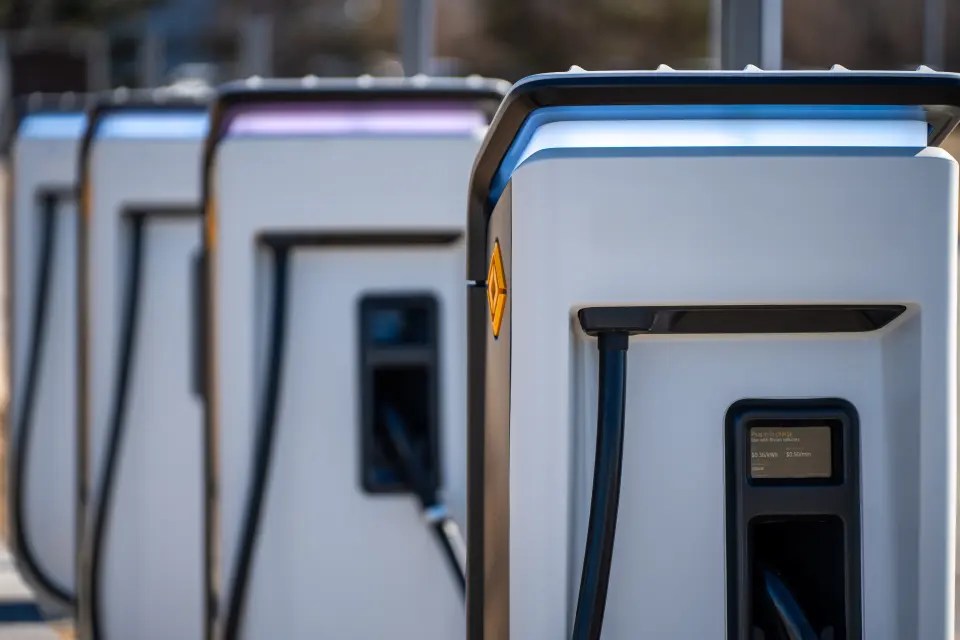
Installing electric vehicle (EV) chargers requires electrical expertise and reliable utility locating to avoid costly or hazardous mistakes. That’s why a service station in Cambridge, Ohio, turned to GPRS for a comprehensive utility mapping solution.
Before digging began, GPRS Project Manager Derrik Clark was on-site to locate and map all underground utilities. Using a combination of electromagnetic (EM) locating and ground penetrating radar (GPR), Clark gathered accurate subsurface data to ensure the safe and efficient installation of EV chargers.
“It’s the exact same approach no matter what [the client’s attempting to do],” Clark said. “Because the goal is for them not to hit any existing utilities [when digging] for obvious safety reasons, and then obviously so you’re not interrupting operations or causing anybody to spend money fixing those things. So, for me, there’s never a different approach to how I locate things, regardless of the job type. I find the underground utilities and mark them.”
Accurate utility locating by GPRS enabled safe and efficient EV charger installation in Cambridge, Ohio.
How EM and GPR Work Together
EM locators detect signals from metallic pipes and cables by either inducing a current with a transmitter or picking up naturally occurring signals from live electrical lines. These signals move through the conductor. They return to the transmitter using a ground stake, which completes the circuit.
GPR sends radio waves into the ground. It reads reflections from subsurface features, such as utilities, rebar, and underground storage tanks. These reflections show up as hyperbolas on the GPR readout. Trained GPRS professionals use them to find location, material type, and depth.
Together, EM and GPR provide a powerful, layered approach to utility locating. It is important to note that environmental conditions can affect performance.
At the Cambridge, Ohio service station, for example, Project Manager Derrik Clark leaned more heavily on EM locating. This was due to an abundance of aboveground contact points, which he could use to create a traceable signal, and the fact that the soil consistency and other environmental factors were interfering with his GPR scanner’s ability to penetrate the asphalt and soil.
“Max depth with GPR was very poor at this site,” Clark said. “It was like a foot-and-a-half, so that’s why I primarily used the EM locator. It’s always a combination of GPR and EM locating, but since GPR was limited so much, I was relying more on the EM locator and hooking onto any surface features that were there.”
From Field Data to Interactive Records
Once the utilities were located and mapped, Clark uploaded the data into SiteMap®. SiteMap transforms raw locating data into interactive records that are securely accessible 24/7 from any device.
This centralized, cloud-based solution gave the entire project team a single source of truth. Helping to eliminate miscommunication, reduce risk, and streamline decision-making. With SiteMap, the installer could confidently proceed without striking any buried utilities, keeping the site and project team safe and on schedule.
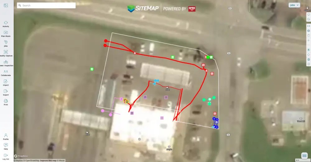
SiteMap® utility mapping software gave the project team 24/7 secure access to their critical data, helping prevent costly and dangerous mistakes.
Why SiteMap® Matters
Whether you’re installing EV chargers, managing a facility, or planning a major construction project, SiteMap delivers the solutions you need to build smarter and safer. It’s a living, interactive record of your infrastructure, designed to support every phase of your project lifecycle.
From skyscrapers to sewer lines, GPRS and SiteMap help you Visualize The Built World®, so you can stay on time, on budget, and above all, safe.
Click below to schedule your free, personal SiteMap demo today!