Locating gas lines is essential for any excavation or construction project. It’s a key safety measure that helps prevent serious accidents and service disruptions.
Using the right techniques and the right solutions to identify these lines can reduce risk, protect your team members, and preserve utility infrastructure. This process often involves reviewing utility records and using new interactive tools that centralize your data and make it easily shareable with your team to reduce risk, protect your crew, and preserve utility infrastructure.
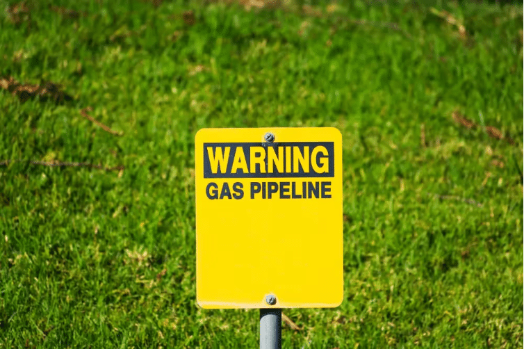
Identifying gas lines before excavation is essential to ensure safety and prevent dangerous utility strikes.
While calling 811 is required by law and an important first step before digging, it doesn’t always provide the full picture. To ensure a more complete understanding of what’s underground, it’s best to bring in a private utility locator to supplement 811’s findings.
Why Locating Gas Lines Can’t Be Overlooked
Digging without knowing what’s underground is a risk no project can afford. Striking a gas line can trigger dangerous leaks, fires, or explosions – putting lives, property, and project timelines in jeopardy.
Beyond the immediate hazards, damaging a gas line can also knock out service, leading to expensive delays and major disruptions for both homeowners and businesses. Taking the time to accurately locate gas lines before excavation is essential because it helps prevent serious hazards and costly disruptions.
The Hidden Risk of Cross Bores
A cross bore happens when a newly installed utility line intersects an existing one. These conflicts can go unnoticed during installation, often surfacing later, especially during maintenance or repair work.
When a gas line is involved, the consequences can be severe. If the intersected line is punctured, it can lead to a gas leak or even an explosion.
Because of this, detecting and resolving cross bores is critical. Our services enabled a major oil and gas company to avoid ground strikes entirely across its Bay Area gas stations. Identifying these risks early is a key step in preventing potentially catastrophic incidents and ensuring the safety of everyone on and around the job site.
How Utility Locating Services Work
Utility locating services like those offered nationwide by GPRS identify the location and path of underground infrastructure, including gas lines. These services consist of a mix of advanced technology coupled with experienced technicians to accurately map what lies beneath the surface.
The process typically starts by contacting local utility companies, who then dispatch locators to mark underground lines using flags or paint.
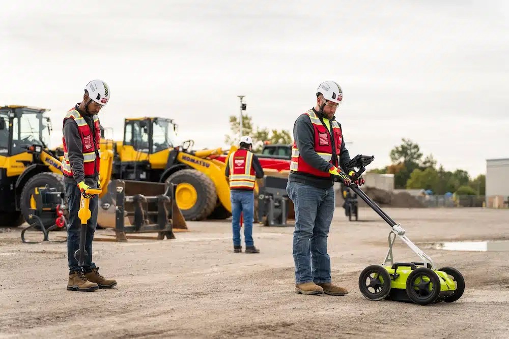
GPRS Project Managers use GPR solutions to locate buried utility lines, then upload verified records into SiteMap®, the interactive software platform that keeps your data accessible and organized.
Core Technologies Behind Utility Locating
Ground Penetrating Radar (GPR): GPR is a non-invasive method that uses high-frequency radio waves to detect objects beneath the surface. When these waves encounter a buried utility, they bounce back, allowing teams to generate a detailed image of what lies underground. GPR is especially valuable for locating non-metallic utilities – like plastic gas lines – that traditional methods often miss.
Electromagnetic (EM) Locating: EM locating works by transmitting an electromagnetic signal through underground utilities. A receiver above ground then picks up the signal, helping technicians pinpoint the utility’s location. This method is highly effective for metallic lines and is widely used for its accuracy and ease of deployment.
Together, these technologies – combined with skilled technicians and modern software solutions – form the backbone of safe and effective utility locating.
Steps for Safely Locating Gas Lines
- Plan and prepare: Start with a clear plan. Define the scope of your excavation and identify the areas that will be affected. Reach out to a professional utility locating service early and share your project timeline to ensure proper coordination.
- Call 811: Before any digging begins, federal law requires you to contact your state or regional 811 call service. An 811 contractor will visit your site and mark the approximate locations of registered public utilities within your dig zone.
- Hire a private utility locator with advanced tools: To go beyond the basics, bring in a private utility locating company that uses technologies like GPR and EM locating. These services often provide additional details – such as utility line depths – that are critical for safe excavation.
- Verify and mark: Experienced private locators use multiple detection methods to confirm utility locations. Once verified, they mark the utilities using flags, paint, or other indicators, ensuring everyone on-site knows where it’s safe to dig.
- Proceed with caution: Even with accurate markings, excavation should be done carefully. Use hand digging or vacuum excavation near marked lines to minimize the risk of accidental damage.
Best Practices for Preventing Subsurface Damage
Here are some key steps to help prevent damage below the surface when digging:
Hand digging and vacuum excavation: When working near marked gas lines, avoid heavy machinery. Instead, use hand digging or vacuum excavation to safely expose utilities. These methods significantly lower the risk of accidental strikes.
Maintain clear communication: Everyone on-site should be aware of where gas lines are located and understand the importance of avoiding them. Regular safety briefings and open communication channels help prevent costly mistakes.
Watch for cross bores: Stay alert for signs of cross bores, especially in areas with recent utility installations. Use tools like GPR and other detection technologies to identify intersecting lines before they become a hazard.
Ongoing training and updates: Keep crews up to date with the latest in utility locating and excavation safety. Regular training ensures that everyone understands current best practices and the importance of protecting underground infrastructure.
GPRS locates what’s underground. SiteMap® keeps it at your fingertips.
Accurate utility locating is the foundation of safe excavation. GPRS leads the industry with Subsurface Investigation Methodology (SIM) certified Project Managers who use advanced technologies to detect and document every utility on site with a 99.8% accuracy rate.
Once your utilities are located, SiteMap® makes sure that information doesn’t get lost. With SiteMap®, all your verified data is placed into our centralized, cloud-based utility management platform. Accessible 24/7 from any device, SiteMap gives you interactive access to your site’s utility records, helping you plan, coordinate, and execute with confidence.
Whether you’re managing a single project or overseeing multiple sites, SiteMap keeps your utility data organized, visualized, and ready to share. It’s the finishing touch on every accurate locate – delivering the complete picture of your site’s subsurface utilities, right at your fingertips when it matters most.
Click below to schedule a live, personal, and free SiteMap demo today!