GPRS Private Utility Locating Costs Explained
When it comes to the cost of utility locating, the most important thing to know is this: with GPRS, you only pay for what you need, and investing in accurate utility locating services saves you far more than it costs.
You can always count on GPRS for straightforward, upfront utility locating pricing built around your project goals and timeline, so you never pay for services you don’t need.
GPRS tailors every utility locating quote by project scope because every building and site are different. Utility locating pricing depends on several factors, including:
- Soil conditions
- Site size
- Utility depth
- Number of utilities present
- Night/weekend work
- Level of detail required
- Deliverables required
GPRS provides pricing based on your specific site and project needs, not a one‑size‑fits‑all rate.
What You Get with Every Utility Locate
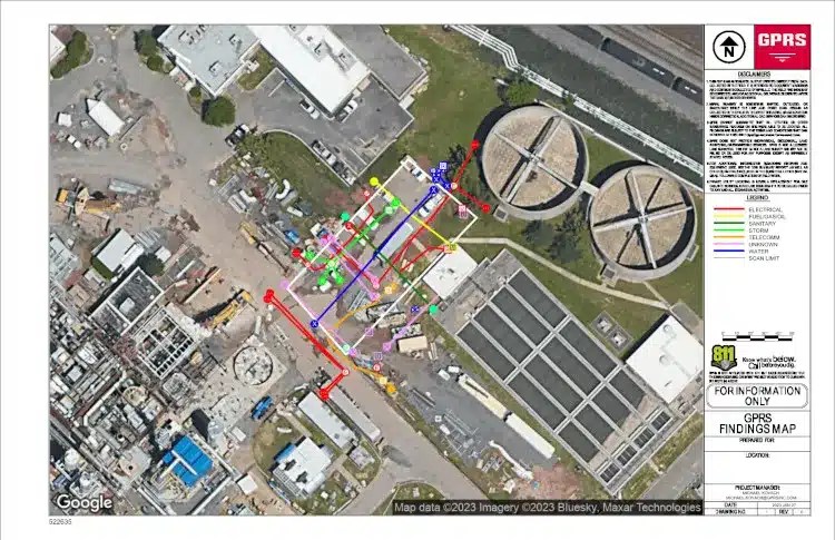
GPRS Project Managers locate, mark, and map all subsurface utilities using ground penetrating radar (GPR) and electromagnetic locating (EM) technology prior to excavation to help prevent strikes, protect your crew, and avoid costly damage and delays.
Comprehensive Subsurface Utility Detection
You will receive on site field markings with spray paint and/or pin flags, color-coded to American Public Works Association standards, plus utility maps to give your team a clear understanding of the exact location, depth, and layout of all underground utilities on your job site, including:
- Electric power lines, cables, conduit and lighting cables
- Gas, oil, steam, petroleum, and gaseous materials
- Communication, alarm or signal lines, cables or conduit
- Potable water
- Reclaimed water, irrigation, and slurry lines
- Sewers and drain lines
- Underground storage tanks
- Abandoned lines
- Unknown utilities
- Manholes & well heads
CAD/BIM Outputs Delivered in SiteMap®
All data is delivered through SiteMap®, GPRS’ secure, cloud‑based GIS platform and mobile app, providing easy access to 99.8% accurate utility locates and a full suite of digital deliverables:
- Job Summary Report
- Layered, interactive utility maps
- PDF and .KMZ formats
- Point clouds captured via LiDAR laser scanners
- 2D CAD drawings
- 3D BIM models and CSM models
- 3D Virtual Tours
GPRS provides PDF utility maps of every utility on site, whether public or private, including depths, and can export your utility data into a wide variety of drawings, maps, and models.
Why Professional Utility Locating Matters
Accurate utility locating helps your team to:
- Avoid costly strikes and delays
- Keep your crew and site safe
- Stay compliant
- Prevent change orders and rework
- Keep your project moving confidently and on schedule
If you share a few details about your site, we can provide a fast, accurate quote for utility locating and mapping services and help you choose the most cost-effective utility locating solution.
Why Accurate Utility Locating is Essential for Damage Prevention
Utility locating services are significantly less expensive than the cost of striking a utility line.
A white paper published in April 2023 by the Infrastructure Protection Coalition (IPC) highlights major failures in the nation’s damage prevention system used to protect the public and prevent damage to underground utility lines. These failures are responsible for over $30 billion in annual societal and utility line damage costs, and an additional $61 billion in annual waste and excess costs.
The Common Ground Alliance 2024 DIRT Report, the only comprehensive accounting of buried infrastructure damages in North America, found that 9 of the top 10 known root causes of utility damages occur during utility work itself. This means that the very activities intended to install or maintain utilities are often the ones most likely to damage existing buried lines when locating is inaccurate.
It is important for general contractors and engineers to carefully plan and complete work with an accurate utility locate and map. By partnering with GPRS for accurate utility locating, your team can prevent costly outages, injuries, delays, and downtime, protecting your people, your schedule, and your budget.
Do You Need Both Public and Private Utilities Located?
Yes, you do. Both public and private utilities need to be accurately located and mapped to ensure safety, avoid costly repairs, and prevent service outages. Public utility locators (811) mark registered lines up to the meter, while private utility locators can both verify your 811 locates, and find service lines beyond the meter that are often unmapped and dangerously forgotten.
More than 65% of all buried utility lines on any given site are unregistered/private utilities that 811 does not locate.
Private utilities are utilities which extend beyond service meters or public utilities, often on to privately owned property. Examples of private utilities can include electrical feeders and gas mains running through parking lots or to critical facilities such as hospitals or fire stations. They can also include lines running to and from substations, heavy industrial facilities, and refineries. These utilities would be owned and maintained by the property owner, placing them outside of the jurisdiction of public utility locating companies.
Thank you for reading this excerpt. Read the full article to learn how SIM-certified GPRS Project Managers deliver field-verified utility data you can access, visualize, and manage in SiteMap to reduce risk and keep projects moving.
Click below to schedule your free SiteMap demo!